
The Met Office has issued a rare ‘thundersnow’ warning as an ‘amber’ alert for snow is in place for parts of the UK, with forecasters warning of ‘life-threatening’ conditions
Weather forecasters have issued a rare ‘thundersnow’ warning as freezing temperatures continue to batter the UK this week.
Thundersnow, as the name suggests, features heavy snowfall rather than rain as the primary precipitation, frequently accompanied by thunder and lightning. This extraordinary meteorological phenomenon develops when atmospheric conditions become turbulent enough to create cumulonimbus clouds and generally occurs approximately 10 times annually across the globe.
Regions across the country predicted to experience snow showers today and continuing into Thursday may encounter thundersnow.
This warning arrives alongside multiple Met Office yellow alerts for snow and ice throughout the UK, reports The Mirror. An amber snow warning remains active for Thursday, encompassing North East England (Redcar and Cleveland) and Yorkshire and Humber (East Riding of Yorkshire; North Yorkshire).
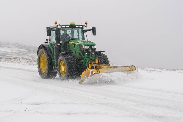
The Met Office states regarding the amber warning: “Frequent wintry showers will feed inland from the North Sea, giving significant snow accumulations over the North York Moors and parts of the Yorkshire Wolds.”, reports Daily Star.
“By the end of Thursday, as much as 15-25 cm may have accumulated on hills above 100 m elevation, which is likely to cause substantial disruption. Gusty winds, giving occasional blizzard conditions, and perhaps a few lightning strikes, may accompany some of the showers, posing as additional hazards.”
Wintry weather patterns are anticipated to persist along coastal areas following snowfall of up to 7cm (2.7in) across portions of the UK. The Met Office has forecasted brighter and drier conditions for central inland areas, with wintry showers expected along the coasts of north Scotland as well as the east and west coasts of the UK, following snowfall overnight and on Wednesday morning.
Snow was reported in areas including London, Hertfordshire, Berkshire, Surrey, Essex, Shropshire and Northumberland, with Met Office weather stations recording 7cm of lying snow at Lake Vyrnwy in Powys, Wales, at 8am.
Other weather stations reporting lying snow include Lerwick in Shetland with 5cm, Loch Glascarnoch and Altnaharra in the Scottish Highlands with 4cm and 7cm respectively, Aviemore in Invernesshire with 2cm, and Dyce in Aberdeenshire, Drumalbin in Lanarkshire and Redesdale Camp in Northumberland each with 1cm.
Multiple yellow warnings for ice and snow have been issued by the Met Office for the coming days, covering Northern Ireland, parts of Wales, northern and south-westerly parts of England and much of Scotland.
Neil Armstrong, Met Office chief forecaster, stated: “Cold Arctic air from the north is firmly in charge of the UK’s weather, bringing the first notable cold snap of this autumn and giving an early taste of winter weather.”
He added: “As a result, winter hazards are likely through the next few days, with snow and ice a particular hazard, and the coldest conditions likely on Wednesday and Thursday.
“Wintry showers will affect areas exposed to the brisk northerly wind, in particular Northern Ireland, southwest Wales, south-west England, north-east England and across the northern half of Scotland.
“Whilst not all places will see lying snow, where showers are most frequent accumulations of 2-5cm will be possible.
“On higher ground in Scotland, 15-20cm could accumulate, and potentially as much as 15-25cm over the North York Moors and Yorkshire Wolds.”