

With Storm Floris set to bring strong winds and heavy rain to the UK, the Met Office has issued ‘weather ready’ advice
UK households are being urged to stock up on a certain item before the start of next week in a fresh Met Office warning. Weather experts have put out an alert for Storm Floris, which is due to bring heavy rain and strong winds to parts of the country on Monday, August 4.
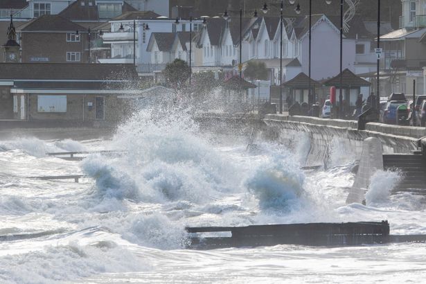
Storm Floris was named on Friday, August 1. Brits were warned that the area of low pressure is set to bring “unseasonably strong winds” and “heavy rain”. The Met Office also says “disruption is possible“. A yellow weather warning for wind has been issued for Monday – starting at 6am and ending on Tuesday at 6am.
It covers the northern half of the UK, including the top part of Wales, northern England, all of Scotland, and Northern Ireland. Residents in these areas are being told they should expect some damage to buildings, such as tiles blown from roofs, which could happen, and injuries and danger to life from flying debris are possible.
The Met Office also says power cuts may occur, with the potential to affect other services, such as mobile phone coverage. Some roads and bridges may close, and road, rail, air, and ferry services may be affected, with longer journey times and cancellations possible.
As a result of the upcoming bad weather, the government agency is urging people to be ‘weather aware’ and to ‘stay weather ready’. In a new post on X, the Met Office put out some advice about keeping yourself, your home and your garden safe.
One piece of advice includes “having basic supplies to hand”, such as stocking up on batteries, should a power cut happen. The Met Office lists: “Torch, batteries and a wind up or battery-operated radio. Water, any medication and a change of clothes. Ket documents and important phone numbers.” A Met Office spokesperson added: “People cope better with power cuts when they have prepared for them in advance. It’s easy to do; consider gathering torches and batteries, a mobile phone power pack, and other essential items.”
Batteries play a vital role during power outages since they serve as a backup power source to keep important devices and appliances operational, which helps ensure safety and convenience. They store energy produced by solar panels or the grid, enabling you to keep essential systems like lights, heating, and medical equipment running when the main electricity supply is interrupted.
Batteries, particularly pre-charged battery banks, are great for powering phones and other communication gadgets, so you can keep in touch with emergency services or your family and access crucial information. When the power goes out, it can really throw a wrench in your daily life. Batteries and torches, for instance, can ease that hassle by letting you keep using important appliances and helping you maintain some sense of normalcy.
Other tips the Met Office included in its post on X focus on weatherproofing your home and garden by checking fences and roof tiles are secure, securing outdoor furniture and storing outdoor items away, as well as clearing guttering and drains of any leaves and debris.
In terms of staying safe for anyone living along the coast, the Met Office recommends: “Check tide times if you’re heading to the coast. Stay away from cliff edges, especially after rainfall. Stay back from stormy seas – the waves can sweep you off your feet. If you see someone in trouble, call 999 and ask for the Coastguard.”
What kind of weather will Storm Floris bring?
A Met Office spokesperson said: “Storm Floris will bring a spell of unusually windy weather for the time of year across the northern half of the UK early next week. The strongest winds are most likely to occur across Scotland during Monday afternoon and night, although there remains some uncertainty in the depth and track of Floris.
“Across the warning area, many inland areas are likely to see westerly wind gusts of 40-50 mph with 60-70 mph possible along exposed coasts and high ground, especially Scotland. There is a chance of a spell of even stronger winds developing for a time, with inland gusts of 60-70 mph and 85 mph along exposed Scottish coastlines and hills.
“Winds will first ease in the west during later Monday, but remain very strong overnight until early Tuesday in the east. Heavy rain may also contribute to the disruption in places.”
Which regions of the UK will Storm Floris affect?
Yorkshire & Humber
- East Riding of Yorkshire
- North Yorkshire
- West Yorkshire
- York
Wales
- Conwy
- Denbighshire
- Flintshire
- Gwynedd
- Isle of Anglesey
North East England
- Darlington
- Durham
- Gateshead
- Hartlepool
- Middlesbrough
- Newcastle upon Tyne
- North Tyneside
- Northumberland
- Redcar and Cleveland
- South Tyneside
- Stockton-on-Tees
- Sunderland
North West England
- Blackburn with Darwen
- Blackpool
- Cheshire West and Chester
- Cumbria
- Greater Manchester
- Halton
- Lancashire
- Merseyside
- Warrington
Central, Tayside & Fife
- Angus
- Clackmannanshire
- Dundee
- Falkirk
- Fife
- Perth and Kinross
- Stirling
Grampian
- Aberdeen
- Aberdeenshire
- Moray
Highlands & Eilean Siar
- Na h-Eileanan Siar
- Highland
Northern Ireland
- County Antrim
- County Armagh
- County Down
- County Fermanagh
- County Londonderry
- County Tyrone
Orkney & Shetland
- Orkney Islands
- Shetland Islands
SW Scotland, Lothian Borders
- Dumfries and Galloway
- East Lothian
- Edinburgh
- Midlothian Council
- Scottish Borders
- West Lothian
Strathclyde
- Argyll and Bute
- East Ayrshire
- East Dunbartonshire
- East Renfrewshire
- Glasgow
- Inverclyde
- North Ayrshire
- North Lanarkshire
- Renfrewshire
- South Ayrshire
- South Lanarkshire
- West Dunbartonshire
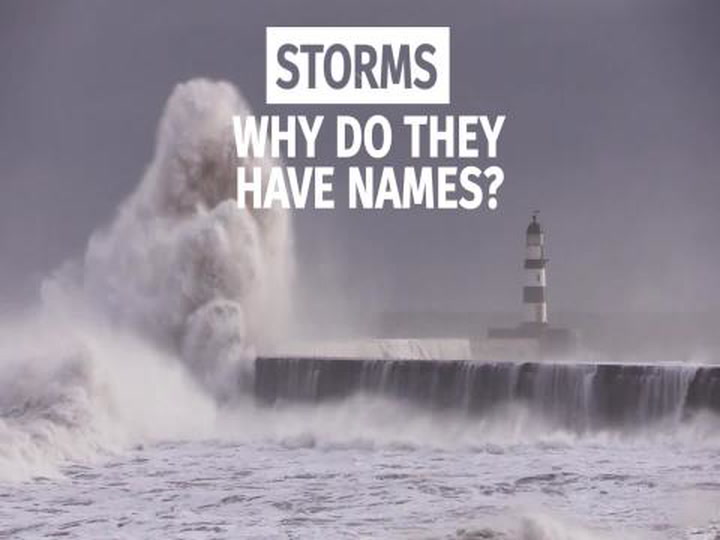
Why do storms have names?
What are the different colours of a Met Office warning?
Yellow warning: Yellow warnings can be issued for a range of weather situations. Many are issued when it is likely that the weather will cause some low-level impacts, including some disruption to travel in a few places.
Many people may be able to continue with their daily routine, but some will be directly impacted, and so it is important to assess whether you could be affected. Other yellow warnings are issued when the weather could bring much more severe impacts to the majority of people, but the certainty of those impacts occurring is much lower. It is important to read the content of yellow warnings to determine which weather situation is being covered by the yellow warning.
Amber warning: There is an increased likelihood of impacts from severe weather, which could potentially disrupt your plans. This means there is the possibility of travel delays, road and rail closures, power cuts, and the potential risk to life and property.
You should consider changing your plans and taking action to protect yourself and your property. You may want to consider the impact of the weather on your family and your community, and whether there is anything you need to do ahead of the severe weather to minimise the impact.
Red warning: Dangerous weather is expected, and if you haven’t already done so, you should take action now to keep yourself and others safe from the impact of the severe weather. It is very likely that there will be a risk to life, with substantial disruption to travel, energy supplies, and possibly widespread damage to property and infrastructure. You should avoid travelling, where possible, and follow the advice of the emergency services and local authorities.