

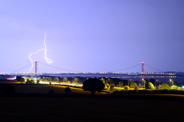
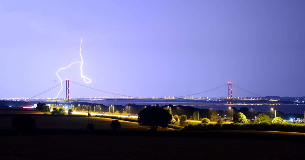
Two thunderstorm warnings have been issued in Hull and East Yorkshire as temperatures climb again with storms potentially producing rainfall that could be “locally torrential”.
The Met Office says there is a risk of potentially ‘disruptive’ storms developing on Friday afternoon and evening, as well as throughout Saturday, fuelled by “a warm and humid airmass”. Two separate yellow-level weather warnings have been announced – one effective from noon until 8pm on Friday, and the second from 9pm on Friday until 6pm on Saturday.
Both alerts cover all of East Yorkshire, with the first more specific to north-eastern England whereas the second includes large parts of the country from Northumberland to the south coast.
In the first warning, the Met Office said: “Showers and thunderstorms will develop across parts of northern England early Friday afternoon, before becoming concentrated across parts of northeast England. 15-25mm of rain is possible in less than an hour, and should storms become aligned across similar areas, 40-60mm of rain is possible, with these higher totals most likely over the North York Moors.
“As well as rain, frequent lightning and large hail are possible. Storms will ease and clear into the North Sea Friday evening.”
The alert for the 21-hour warning starting at 9pm on Friday says: “Thundery rain will reach the south of the warning area later Friday before spreading north to affect much of England through Saturday. Rain will likely be locally torrential, bringing 20-30mm in less than an hour in many places, with 60-90mm in less than three hours possible in a few places. Whilst rain will clear from the south of the area by early Saturday afternoon, further thunderstorms are likely to develop here.
“As well as heavy rain, impacts from frequent lightning, gusty winds and large hail are also likely.”
After days of temperatures in the low 20s following last week’s hot spell, the mercury is set to climb to around 26C on Friday with “warm and humid” conditions arriving today followed by a “muggy” night.
The higher temperatures look to be fairly short-lived, however, with “cooler and more unsettled” weather from Saturday onwards with highs expected to be between 21 and 23C over the weekend.
Met Office Chief Meteorologist Jason Kelly, said: “More warnings could be issued for the weekend and early next week. Keep an eye on the Met Office forecast for updates as the picture develops.
“Within the warm and humid airmass we will potentially see temperatures reaching 30C or more for parts of eastern England by Friday, with very warm and muggy conditions continuing into the weekend in parts of central and southern England.”